
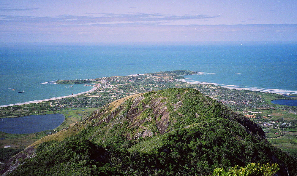
Fort-Dauphin, located in the deep southeast of Madagascar, is a captivating tourist destination. Situated on a small peninsula surrounded by beaches and breakers, the town offers stunning views of the Anosy mountain chain and Peak St. Louis. With crescent-shaped beaches nestled under forest-clad mountains, Fort-Dauphin provides a unique and unspoiled change of scenery compared to other popular Madagascar destinations. Founded in 1643 by the French East India Company, Fort-Dauphin, also known as Tolagnaro, has a pleasant subtropical climate and a breezy port. The town boasts a rich history, having served as a trading post in the 17th century and hosting various historical sites from the colonial era, such as Sainte Luce and Fort-Flacourt. It has developed into a hub for a thriving tourism industry, offering a range of hotels and attractions.
The town’s beaches include the sheltered Libanona Plage on the west side, the surfers’ Plage Monseigneur on the east side, and Plage Ankoba, known for good surf. Libanona Beach, considered the most beautiful and cleanest in Tolagnaro, has a fascinating history and is celebrated for surfing, with the international surfing day observed every June 20th. Fort-Dauphin is also known for the seasonal passage of humpback whales and the presence of dolphins off the coast. The town, known as Tolagnaro, is a vibrant destination on Madagascar’s coast, offering a variety of ethnic foods, flavors, and fashion. The local cuisine features rice as the main course, complemented by meat, poultry, or fish, prepared simply with accessible spices.


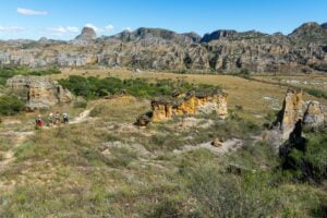
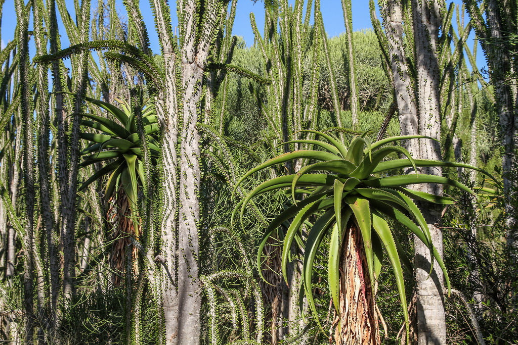
Andohahela National Park, situated in the south of Madagascar, encompasses 760 km² across three non-contiguous sections along the Anosyennes Mountains. This park is home to the last dense and humid forests in southern Madagascar. It features diverse climates: a wet tropical forest in the east, a semi-arid dry forest in the west with thorny bushes, and an intermediate transition zone. The best time to visit is between April and October, with varying climates throughout the park. The eastern region and Anosy range are humid and hot, while the western area is drier with minimal rain from December to March. Temperatures stay warm (20 to 27°C) year-round.
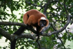
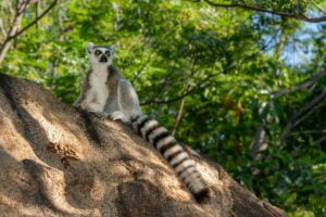
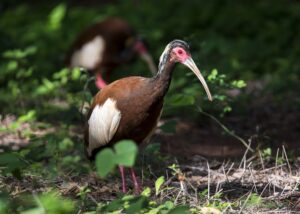
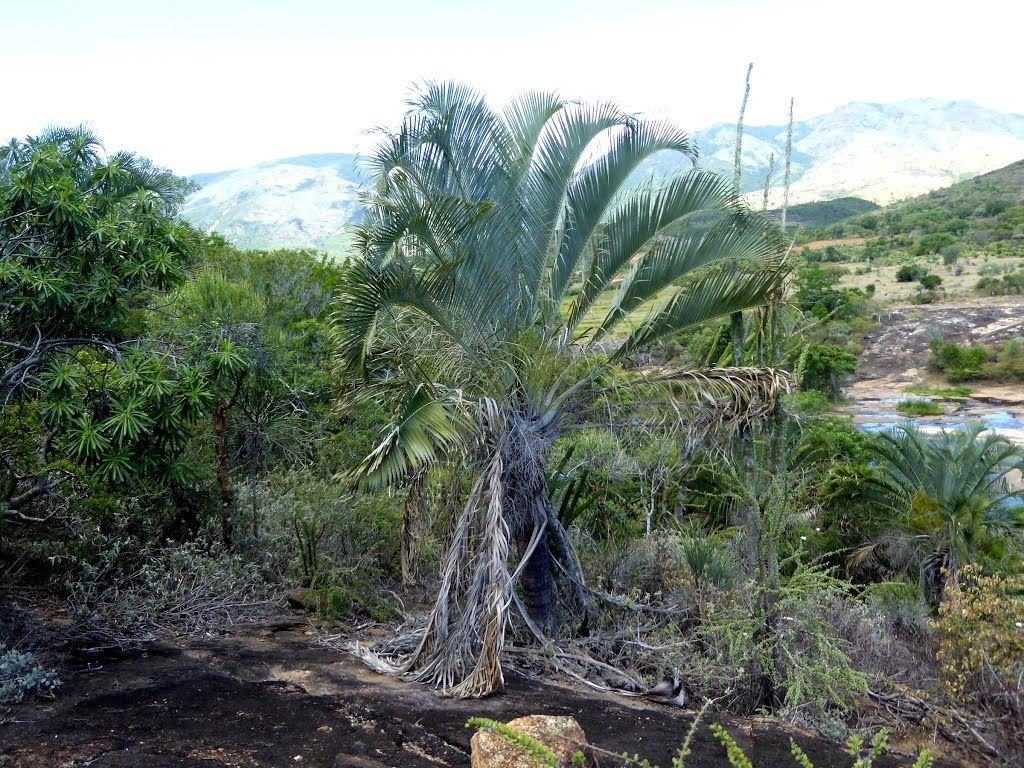
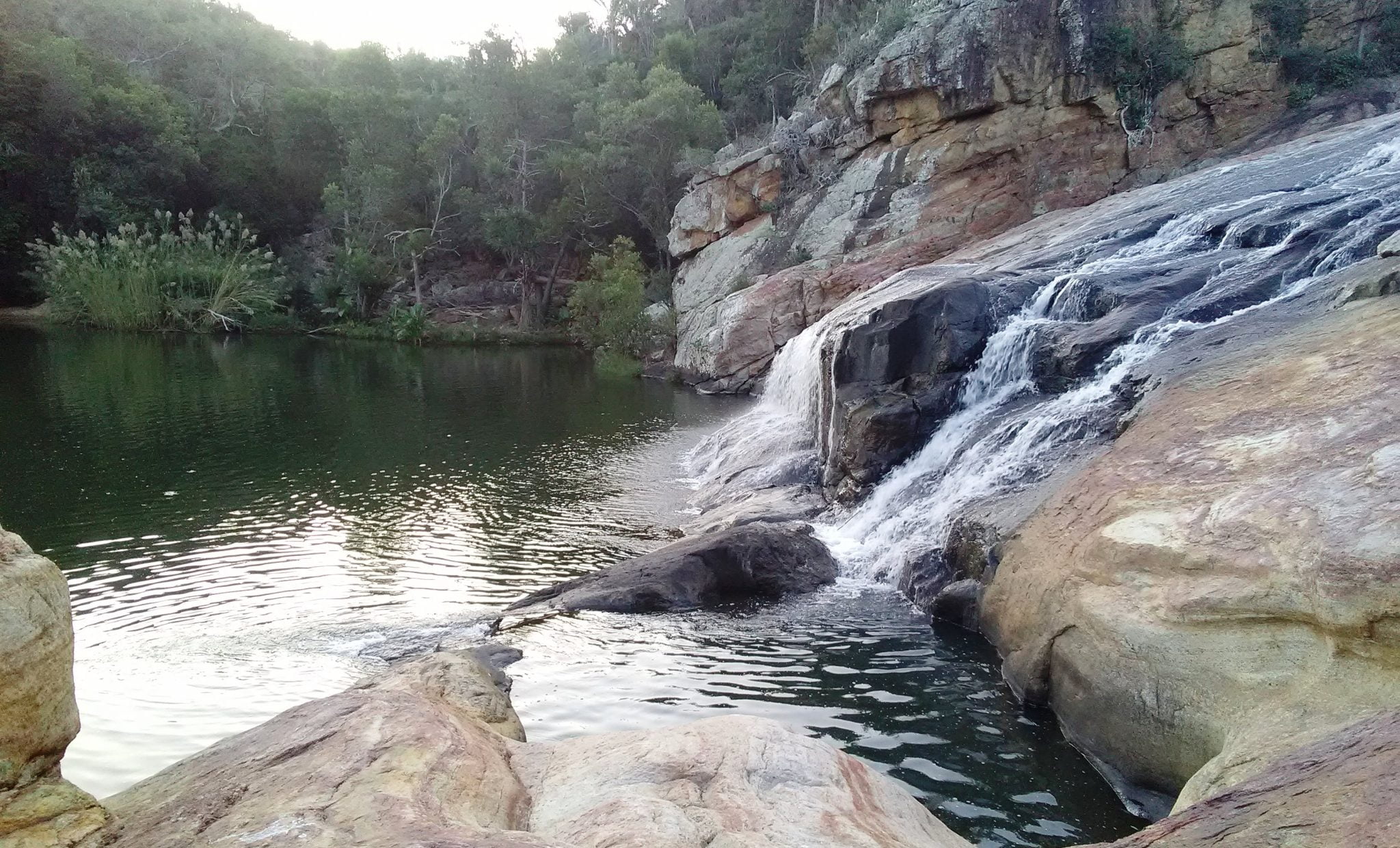
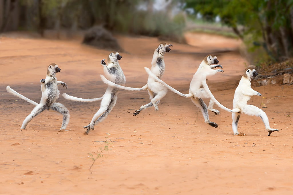
The rainforest section is perfect for wildlife sightings, including red-collared brown lemurs and southern bamboo lemurs. The Andohahela sportive lemur is exclusive to this area. The park offers excellent guided tours and camping facilities. Ihazofotsy (Parcel 2) is renowned for ring-tailed lemurs and Verreaux’s sifaka, with night hikes revealing nocturnal lemurs. It is accessible by four-wheel drive, located a few hours from Tolagnaro. Parcel 3 at Tsimelahy, north of the main road to Amboasary, features an outstanding trail through transitional forest with baobabs, Pachypodium spp., Alluaudia spp., and the triangle palm (Dypsis decaryi). Although it has fewer lemurs, it offers a captivating botanical experience, taking two to three hours to explore. The road is rough but navigable with a four-wheel drive vehicle.

The Berenty Private Reserve in Madagascar, established in 1936 on a sisal plantation, has welcomed tourism since 1980. Located approximately 82 km west of Tolagnaro Airport, the three-hour drive is ideal for a full-day trip due to the scenic route. Berenty is a top destination for lemur enthusiasts, offering the chance to see various lemur species, including ring-tailed lemurs and Verrreaux’s sifaka. Despite occasional high-season crowding, Berenty remains a charming spot with excellent wildlife viewing, including a roosting site for the Madagascar flying fox. Noteworthy wildlife includes a population of hybrid lemurs and three nocturnal species.
Research on ring-tailed lemurs led by Dr. Alison Jolly spans nearly 50 years, with recommended readings like « Lords and Lemurs. » Covering 250 ha along the Mandrare River, Berenty features gallery and spiny forests within a sisal plantation. Guided tours to nearby forest patches such as Bealokoa and Anjapolo are recommended. The diverse avian fauna includes Madagascan Sandgrouse, Couas, Vangas, Lovebirds, Warblers, and Owls. Night outings provide chances to see the Rainforest Scops Owl, White-browed Hawk-Owl, and Torotoroka Scops Owl.


Manakara, located in the south of Madagascar among historic seaside towns like Fort-Dauphin, Tolagnaro, Mananjary, Vohipeno, Farafangana, and Vangaindrano, offers unique coastal experiences. These towns are among the best coastal destinations in Madagascar, providing a less crowded alternative to other coastal areas. Once a bustling colonial hub with vast coffee plantations, Manakara is now somewhat isolated due to limited flights and seasonal road access. However, it’s an underrated destination gaining traction among discerning travelers.
Accessible via the rehabilitated « little train of the cliffs, » the world’s steepest train, Manakara offers a thrilling journey through primeval forests and steep slopes. Explore the Pangalanes Canal for a refreshing break from the highlands, showcasing lively scenes of rowing canoes, fishing villages, and lush vegetation.
Manakara is divided by the canal, featuring the vibrant Tanambao with a Caribbean vibe on one side, and the breezy Manakara-Be district with colonial-style houses on the other. Situated between the river and the Indian Ocean, the town boasts a coastal ambiance with villas, gardens, and coconut trees. Although the beaches have strong currents, the « Trou du commissaire » enclave provides safe swimming. Known for its cleanliness, Manakara is a peaceful town with wide, unpaved streets and rickshaws as the primary mode of transport.
For relaxation, visit Vanille Beach or enjoy scenic bike rides along the ocean after a thrilling train journey. As the capital of the Antemoro people, Manakara features Islamic influences with numerous mosques and the preservation of « Sorabe, » sacred texts in Arabic. Don’t miss exploring the Antemoro paper factory and the town market for traditional Malagasy paper.


The Ifotaka Community Forest, located in the south of Madagascar in the Androy region, is a remarkable area home to the Antandroy tribe. Spanning 22,000 hectares, this culturally rich forest shelters ancestral tombs of the Antandroy people. To reach Ifotaka, embark on a 4-hour jeep tour through diverse landscapes including wetland forests and the unique spiny forest, known for its distinctive wildlife and flora. Alternatively, light aircraft transfers from Fort-Dauphin are available.
Ifotaka Community Chalets (CCI), situated near the Mandrare River, provides accommodation for visitors. Established by the Tandroy Conservation Trust in 2003, these community-owned chalets support biodiversity conservation.
Experience the Antandroy’s unique cultural practices and their use of thorn plants around villages. The Ifotaka Forest boasts well-preserved gallery and spiny forests, home to Ring-tailed lemurs, Verreaux’s Sifakas, and diverse bird species like the Madagascar Buzzard and Peregrine Falcon. Night walks reveal Mouse lemurs and White-footed sportive lemurs. Marvel at the majestic baobabs, including Adansonia za, the largest species in the region, creating a mini Avenue of the Baobabs.


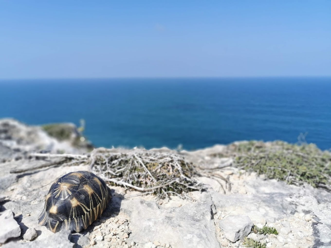
Cape Sainte Marie, also known as Tanjon’ny Vohimena in Malagasy, marks Madagascar’s southernmost tip, offering a remote and windswept environment. Established in 1962 as a special reserve to protect 14 bird species and two rare tortoise species, it is crucial for unique fauna and flora. Here, the Indian Ocean and the Mozambique Channel converge, featuring a functional lighthouse amidst strong winds. Located on the southern border of the Mahafaly Karimbola plateau, the area is arid with spiny forests and moving dunes, creating a distinct ecosystem.
The Cape Sainte Marie Special Reserve is home to significant populations of terrestrial and marine turtles, including the radiated and spider turtles, which inhabit this coast. Despite efforts, poaching threatens these endangered turtles. From June to October, the reserve also witnesses a captivating migration of humpback whales.
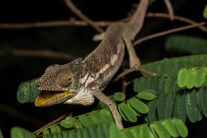
In this harsh environment, various mammals such as nocturnal lemurs, tenrecs, and bats thrive. Endemic bird species like Verreaux’s Coua and the littoral rock-thrush, alongside diverse reptiles including the three-eyed-lizard, boas, geckos, and chameleons, enhance the reserve’s biodiversity. The vegetation features dwarf plants forming a unique spiny bush, with baobabs and Madagascar periwinkle enriching the landscape.
Visitors can explore the reserve through two trails: the Cape circuit, which navigates the dwarf spiny forest, and the Cave circuit, offering views of elephant bird eggs, a significant turtle population, a sacred cave, and moving dunes. Along the coast, Faux Cap (Betanty) provides scenic views and is a picturesque fishing village with a protected lagoon. Although historically misattributed as the southernmost village, Betanty remains a charming destination.
For those interested in Madagascar travel and guided tours to explore the wildlife and unique animals in the south of Madagascar, this region offers an unforgettable experience.


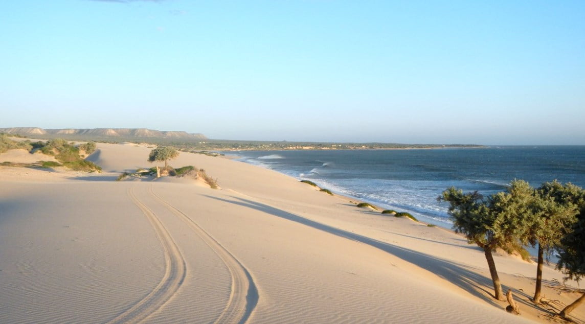
Lavanono, a hidden gem in the south of Madagascar, captivates visitors with its timeless charm. Here, nature reigns supreme, and only a few houses constructed from natural materials stand. Positioned on the « left » of Lavanono, it attracts enthusiasts from the entire region, especially those traveling the Great South track between Tulear and Fort-Dauphin. Near Cape Sainte Marie, the Cape Sainte Marie Special Reserve, known for its turtle population, is just 20 km away.
Internationally renowned for its stunning waves, Lavanono is a premier destination for surfing, windsurfing, and kitesurfing. Surfers enjoy the solitude, with waves reserved just for them. From July to November, humpback whales add to the spectacle. The landscape, shaped by an ancient asteroid fall, offers a mesmerizing blend of cliffs and sea, especially at sunset. Lavanono’s coastline features diverse scenery, from sandy beaches to rocky stretches with exhilarating waves.
As one of the most isolated surf spots globally, Lavanono has recently embraced eco-tourism. The region’s biodiversity, including endemic species, makes it a haven for nature enthusiasts. Despite limited infrastructure for surfing, visitors can explore the local ecosystem and enjoy their stay. Surfers rise with the sun, savoring three meals a day and catching perfect waves in the cross-off winds from July to November. A local party welcomes newcomers with music, homemade brews, and traditional dances. The laid-back atmosphere invites days of beach wandering and relaxation. The return of fishing boats in the evening becomes a communal event with shared catches and lively celebrations.
With around 500 inhabitants, Lavanono remains relatively untouched by mass tourism, offering an isolated retreat with resorts catering to windsurfers. The hope is that this hidden paradise will continue to be a haven for those seeking the perfect blend of wind and waves without falling victim to mass tourism too soon.


Explore Madagascar’s enchanting biodiversity, vibrant culture, and untouched landscapes with Calm Adventure Tours – the best and reliable tour operator. From lush rainforests to pristine beaches, this island paradise awaits nature lovers and adventure seekers. Immerse yourself in the beauty of Madagascar with us.
Copyright © 2024 Calm Adventure Tour By Ilay Gasy.